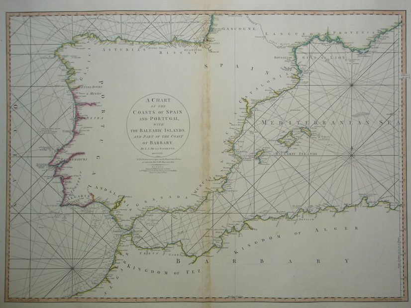
Carta Marina de las costas de España y Portugal del siglo XVIII
220.00€
Descripción
A Chart of the coasts of spain and Portugal with the Balearic Islands, and part of the coast of Barbary. Mapa grabado en plancha de cobre de 1780, segundo edición, con los perfiles de las costa coloreados a mano. Obra del cartógrafo La Rochette. Engraved and published as the act directs by W. Fadden Successor to the late T. Jeffreys, Geographer to the King Charing Cross. June 28 th 1780. Marca de doblez en el centro.
Tamaño del mapa 51 x 70 cm
Ref 236.6